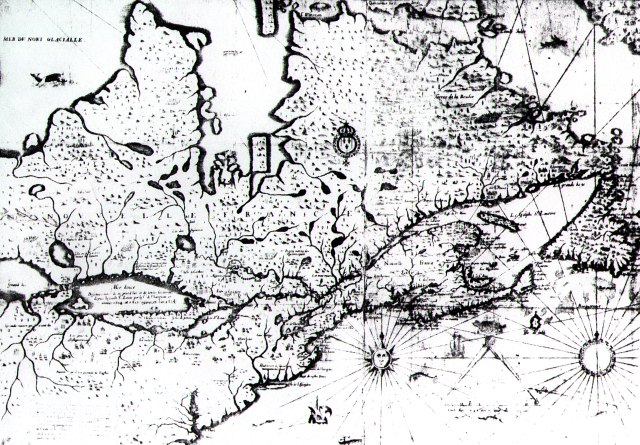
Champlain's 1632 Map
 Champlain's
well known map of New France, printed in 1632. Except for the Virginia
area, Labrador and Hudson Bay coastline and Newfoundland, the map is based
entirely on Champlain's expiration. The map is part of the National Collection,
Public Archives of Canada and was taken from Heidenreich, Conrad, 1936- Seventeenth
Century Maps of the Great Lakes. The copy I looked at was part of the
Michigan Library, Mich GA 405.H43Z
Champlain's
well known map of New France, printed in 1632. Except for the Virginia
area, Labrador and Hudson Bay coastline and Newfoundland, the map is based
entirely on Champlain's expiration. The map is part of the National Collection,
Public Archives of Canada and was taken from Heidenreich, Conrad, 1936- Seventeenth
Century Maps of the Great Lakes. The copy I looked at was part of the
Michigan Library, Mich GA 405.H43Z
Notice how Georgian Bay is shown large with Lake Huron as an after
thought. It is clear that their expirations were through Georgian Bay and
up through the Soo to Lake Superior and not through the Detroit River.
I believe he initially reached Georgian Bay by going overland to the south east corner of the bay and only later used the French River route. That would explain why all of the north east shore of the bay is so well defined.
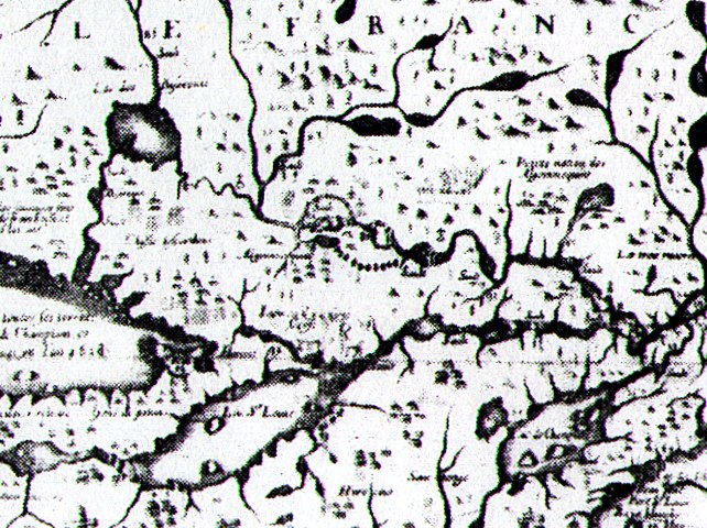
This detail shows the path of the Voyagers from Montréal on the Saint Laurence River along the Ottawa river to Ottawa and up to Lake Napissing then down the French river to Georgian bay.
Rev 8/31/02