Day Trips on the Water
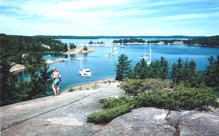
Little Current
Little
Current is a great place to visit by water as well as car.
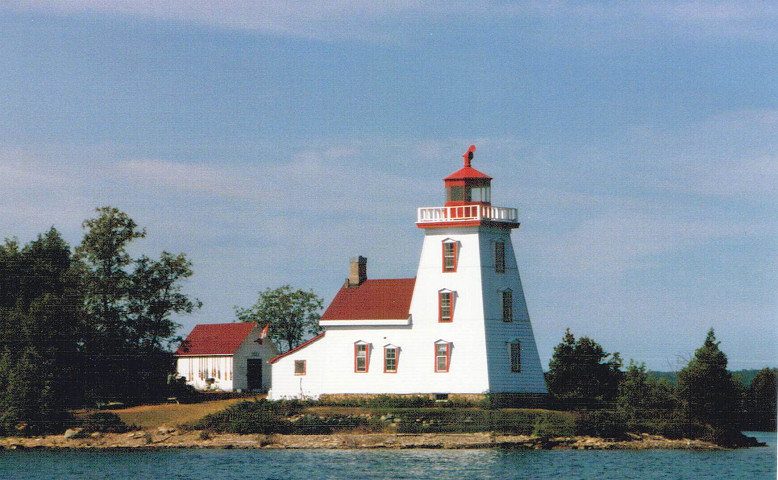
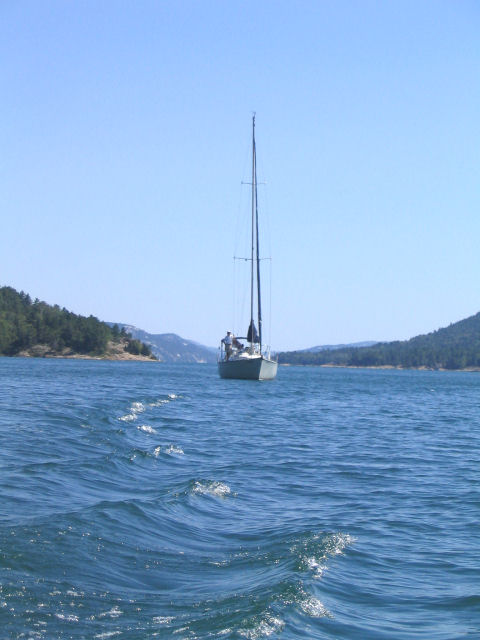
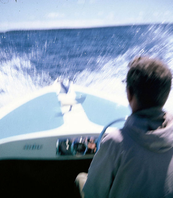
On the way to Little Current 20 kilometers (12 miles) by boat.
 There
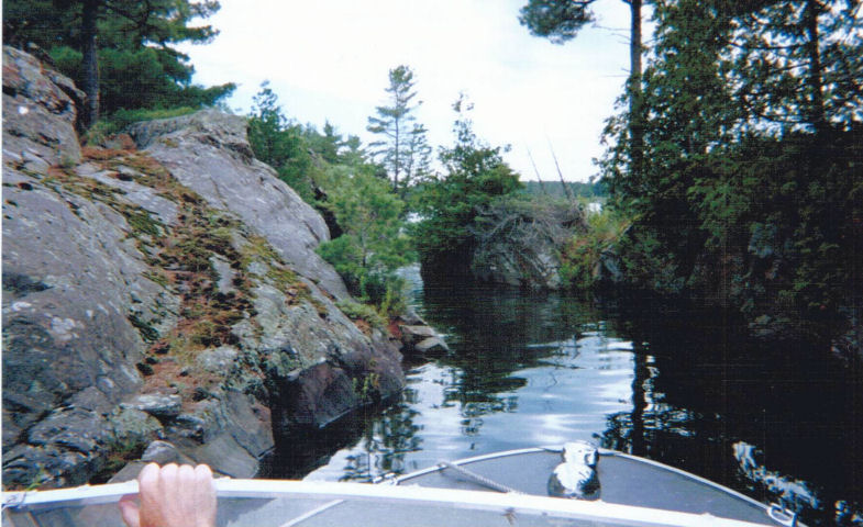
are many interesting places to visit in the upper parts of McGregor Bay.
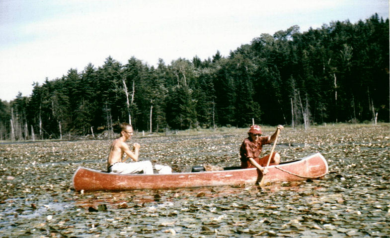
Here we are working our way carefully through Dog Home Pass.
There
are many interesting places to visit in the upper parts of McGregor Bay.
Here we are working our way carefully through Dog Home Pass.
It's always a challenge, we did not make it that year. The water level needs to be fairly high.
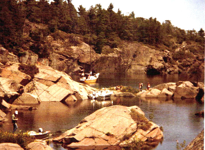
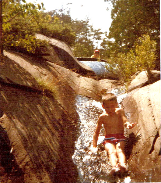
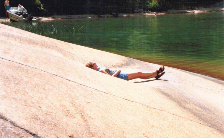
These pictures of Pot Hole Portage were taken quite a long time ago because the kid sliding down the shoot is Travis. This is another interesting destination up in McGregor Bay
Visit the Wreck of the India
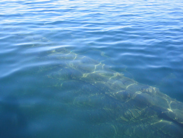
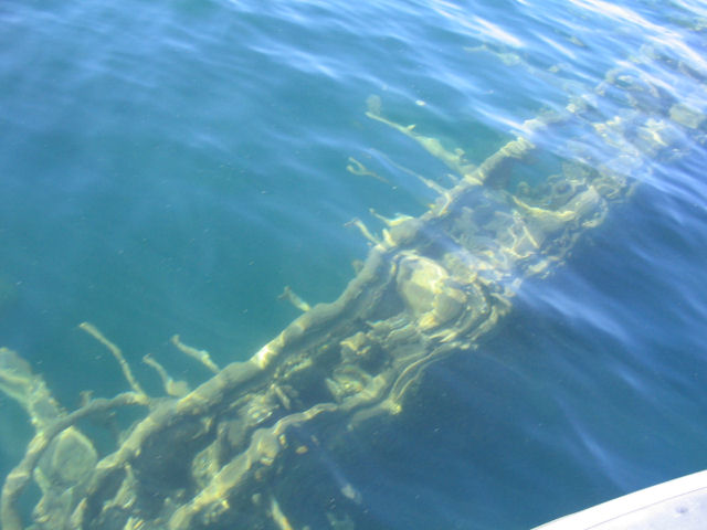
 This
ship, built in 1899 has sunk in 10 to 25 feet of water just off the north east
corner of West Mary Island. The island is between McGregor Point and Little
Current and is just south of Little La Cloche Island. Look for
a temporary float marking the spot of the wreck. West Mary Island is kind
of crescent shaped and the wreck is about in the middle between the points of
the crescent.
This
ship, built in 1899 has sunk in 10 to 25 feet of water just off the north east
corner of West Mary Island. The island is between McGregor Point and Little
Current and is just south of Little La Cloche Island. Look for
a temporary float marking the spot of the wreck. West Mary Island is kind
of crescent shaped and the wreck is about in the middle between the points of
the crescent.
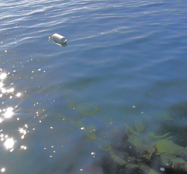
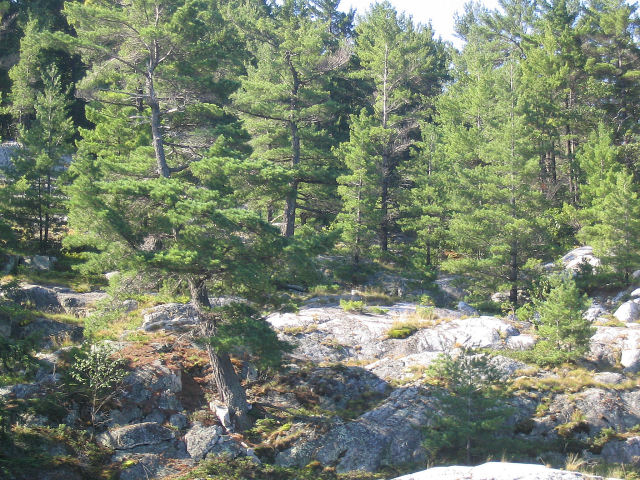
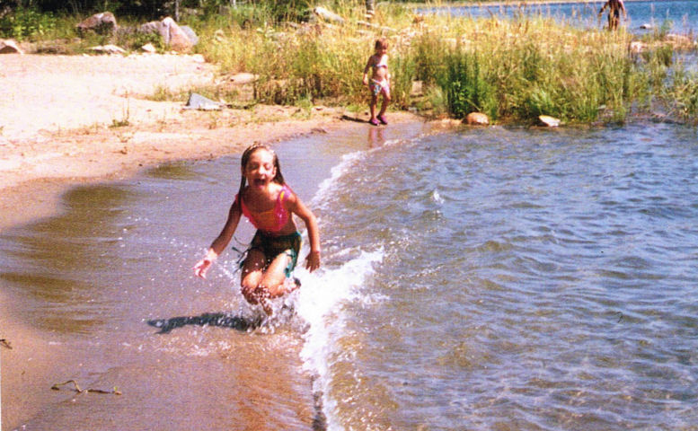 Sandy
beaches are rare in this area but they do exist. This one is about
2.5 kilometers (1.5
miles) south of the island.
Sandy
beaches are rare in this area but they do exist. This one is about
2.5 kilometers (1.5
miles) south of the island.
The kids are Dave's two nieces.
Dave and his mother canoeing on Kirk Creek. Kirk Creek flows in to the pool at the end of Baie Fine. To find it search for a small channel that comes in through the lily pads. It is then about a 0.5 Kilometer portage to a large beaver dam and the lake.
Hike
to the top of Dreamer's Rock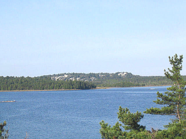
 This
is a very sacred site for the people of the Whitefish River First nation. The North Channel and
St. Mary's River: A guide to the History says the trail to the top is open
to visitors Monday
This
is a very sacred site for the people of the Whitefish River First nation. The North Channel and
St. Mary's River: A guide to the History says the trail to the top is open
to visitors Monday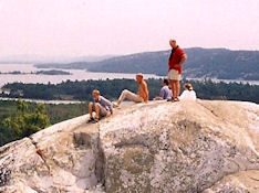 to Friday 9 AM to 4 PM except for special events in the spring and fall. It
is closed on the weekends. I am not certain this data is current so check
at the First Nation Center at Birth
Island, 705-285-4532. Turn towards Bay of Islands at
the Roman Catholic Church. The First Nation Center is just a short way down the road. The top of Dreamer's rock is 775 feet above sea level, 200
feet above the lake.
to Friday 9 AM to 4 PM except for special events in the spring and fall. It
is closed on the weekends. I am not certain this data is current so check
at the First Nation Center at Birth
Island, 705-285-4532. Turn towards Bay of Islands at
the Roman Catholic Church. The First Nation Center is just a short way down the road. The top of Dreamer's rock is 775 feet above sea level, 200
feet above the lake.
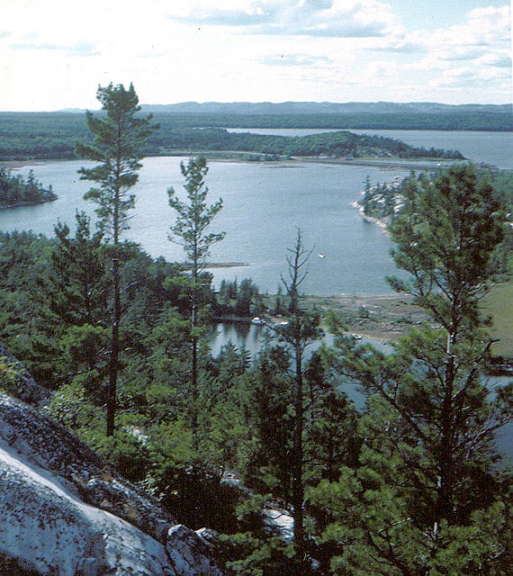
Hike
to the top of Quartz Rock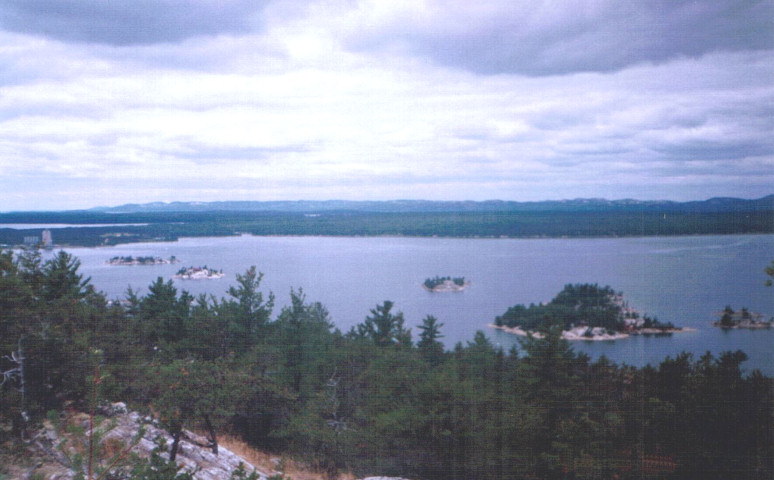
Quartz
rock is the high point just up the bay from McGregor Point at the
mouth of McGregor Bay. It is just across from the Island. There is
no
established trail but you can work your way up from either side of the peninsula or do a hike from one side to the other and arrange for a pick up. The
second island from the left is the island featured on this web site. The
peak is 1075 feet above Sea
level, 500 feet above the lake.
 The
two people on top are Dave and Ava. Notice the climbing
rope in the background. We were doing some
rappelling off cliffs on the
south side. The rocks had not seen much use and consequently had loose
spots. At one point a rock that weighed much more than a man came crashing
down. The sound was worrisome but no injuries resulted. Early 90's.
The
two people on top are Dave and Ava. Notice the climbing
rope in the background. We were doing some
rappelling off cliffs on the
south side. The rocks had not seen much use and consequently had loose
spots. At one point a rock that weighed much more than a man came crashing
down. The sound was worrisome but no injuries resulted. Early 90's.
Hike to the top of Frazer
Bay Hill
Double Click on the panoramic picture above for more pictures and a detailed
description of the climb.
Take
a boat trip up Baie Fine
The bay was originally named by the Voyageurs or earlier French Explorers so
that is why it is usually spelled the French way.
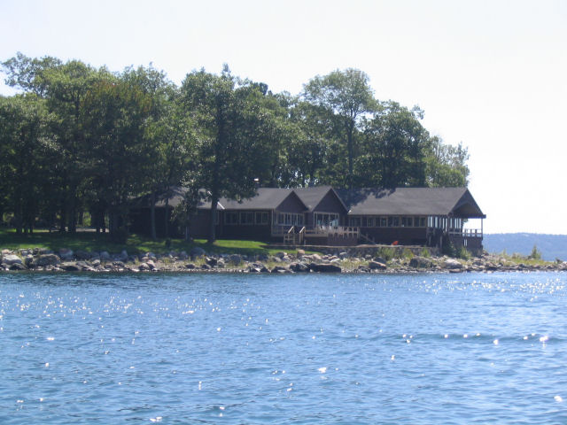
Okeechobee
Lodge at the mouth of Baie Fine.
The lodge was built in 1947 and has been in private hands since 1999.
YouTube has some videos or reunions held there in 2009 and 2010. They
show some interior shots.
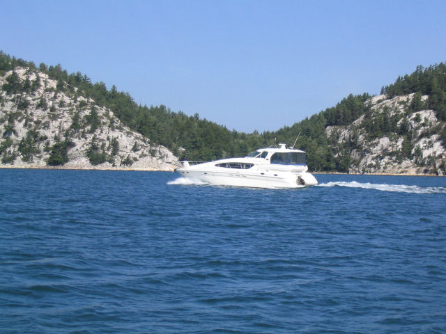
A boat heading up Baie Fine
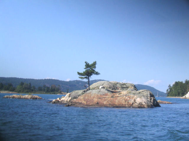
An Island in Baie Fine
Both mountain sides are shown of this 13 kilometer (8 mile) long narrow fjord of Bay Finn.
A typical shore scene along Baie Fine.
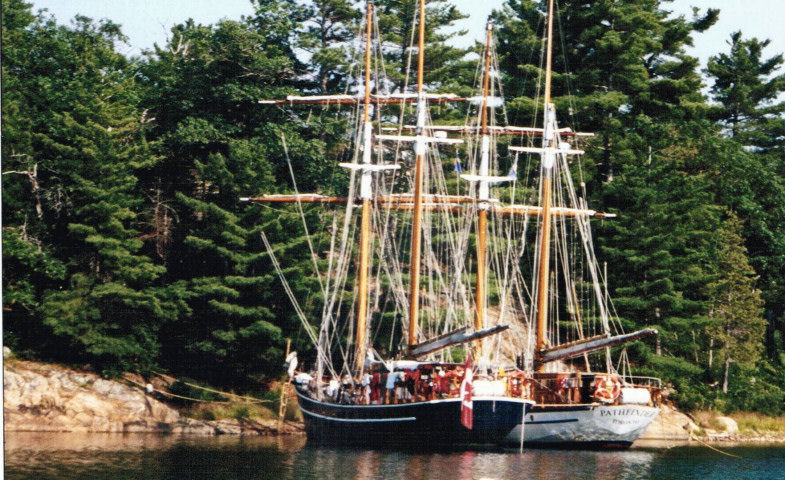
These two ships are tied up in The Pool at the end of Baie Fine. They are used in a coed youth program, with about 15 kids each
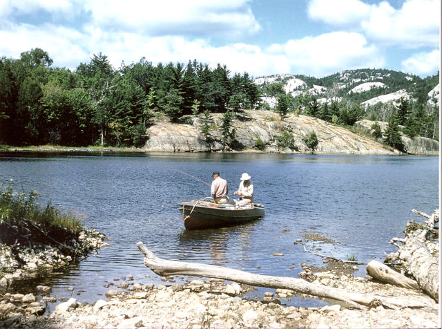 Fishing
has long been popular here. This picture of David Whitaker and Charlie
Barklay dates from 1958
Fishing
has long been popular here. This picture of David Whitaker and Charlie
Barklay dates from 1958
The Barklays were regular visitors to the island in the early years. My
favorite story about Charlie was of the time he was heading out one rainy day.
His wife, without looking up from her book, reminded him to take is rain coat.
Dave was watching him at the time. When he got the reminder, he was
reaching for the rain coat. Upon hearing the reminder, he withdrew his
hand and headed out without it.
Explore the Benjamin
and Hook Islands
The
Benjamin islands are made of red granite and are considered the crown jewels of
the North Channel. It is a great place to see a few sailboats in a beautiful
setting. Boating magazine described it as "One of the best
cruising places in North America".
Benjamin Islands harbor, 42 kilometers (25 miles) from the island.
Relaxing on a Benjamin Island. (1998)
Hook Island is just west of the Benjamins and is a non-descript
looking island but is a great place to look for fossils. The most common
type are called Nautiloids and look kind of like a stack of small cookies.
Island to French River
 Aside
from this satellite picture courtesy of Microsoft's Windows Live,
I do not have any pictures for the best day trip of all, the trip to the mouth
of the French River. The scenery is not spectacular but it is good.
What is spectacular is the total experience of this long trip. It takes a
long day and is best done when the weather is favorable.
Aside
from this satellite picture courtesy of Microsoft's Windows Live,
I do not have any pictures for the best day trip of all, the trip to the mouth
of the French River. The scenery is not spectacular but it is good.
What is spectacular is the total experience of this long trip. It takes a
long day and is best done when the weather is favorable.
The trip begins with an open passage south across Frazer Bay to the Hole In The Wall, then east to Killarney where one should top off all gas tanks. We then continued through the passage skirting the left shore for 7 kilometers (4 miles) until we got to Collins Inlet. This is a 20 kilometers (12 mile) long channel that goes most of the way to where the French River empties into Georgian Bay. At this point you have to get out into open water and continue east to the mouth of French River. In reality there are many entrances, so it is a bit confusing. Returning, you can continue all the way back to Killarney in the open water of Georgian Bay, or tuck back into Beverstone Bay, and then on to the inside channel of Collins inlet. Finding the entrance is not as easy as you would expect even given that you came out of it only a few hours earlier. The problem is that there is a mass of islands along the shoreline and it is difficult to find the channel amongst them. There is a buoy but we missed it and had to double back.
Circumnavigating Manitoulin Island
This trip does not
strictly belong here as it is a two day drip in an outboard. 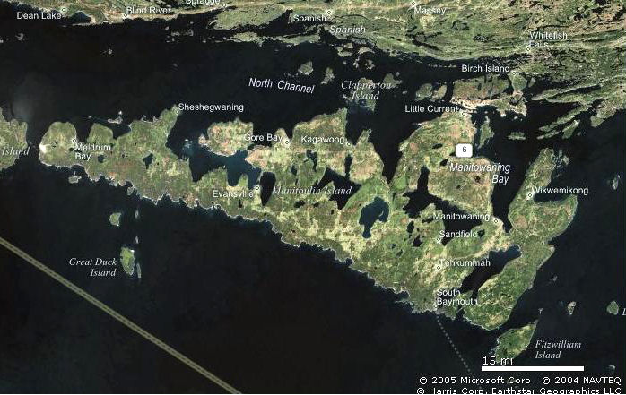 Again I have no pictures (except for the satellite picture courtesy of
Microsoft's Windows Live http://local.live.com
) and it is not particularly picturesque anyway. It is
high adventure because you are in the unsheltered water of Lake Huron for almost
half of the trip. Most of that time you are not near any sort of port either
as the south side of Manitoulin Island is much less developed because it is so
much more exposed. We have only done the trip once and the only other
person we know who did it used a canoe with a small outboard on it. I do
not remember how long it took him.
Again I have no pictures (except for the satellite picture courtesy of
Microsoft's Windows Live http://local.live.com
) and it is not particularly picturesque anyway. It is
high adventure because you are in the unsheltered water of Lake Huron for almost
half of the trip. Most of that time you are not near any sort of port either
as the south side of Manitoulin Island is much less developed because it is so
much more exposed. We have only done the trip once and the only other
person we know who did it used a canoe with a small outboard on it. I do
not remember how long it took him.
Our trip began casually enough. We were heading out to South Baymouth, a challenging trip in itself. The weather looked very promising but just in case, we brought along all our spare gas cans and Dave's insulin. The members of the party were Dave, Ava, Dave's dog Ben, and myself, Bill.
When we got to South Baymouth the weather was holding so we decided to try to make it all the way around to Meldrum Bay by nightfall. We stopped in Providence Bay for gas and supplies (mostly a tooth brush for Ava) and made reservations at the Meldrum Bay Inn. At the time of our trip, about 1990, Providence Bay had so few visitors by boat that we had to hike to a gas station to get fuel. The Inn has been substantially restored since we were there which is a good thing. It is a very historic building and includes a restaurant as well as 8 rooms upstairs. In keeping with the historic nature, the rooms feature a bathroom down the hall. It is getting high reviews on Yelp.
We had been warned that the water was very shallow well out from shore on the south west part of the island. When you get this warning from a canoeist, you have to take it seriously. Sure enough we almost hit bottom and had to swing even further out to sea. Aside from that the trip to Meldrum Bay was uneventful. The weather held, which was vary good because the only alternative to toughing it out would have been to pull the boat up on shore.
We got to Meldrum Bay well before dinner so we had some time to wonder around town. We had a good meal at the Meldrum Bay Inn, then retired for the night with Dave in one bed and Ava and I in the other. Ben was left tied up in the boat which was tied up to the dock. Ben was not amused and Dave ended up taking a blanket out to the boat and sleeping with Ben.
The next day the wind picked up to average levels which made for a somewhat choppy but uneventful trip back to the island.
Fun Out in the Bay (When we were young and foolish)
Charts of the area:
2204 Byng Inlet to
Killarney
Sheet 3 French River to Beaverstone
Bay
Sheet 4 Beaverstone Bay to
Killarney (Includes all of Collins Inlet)
2205
Little Current to Killarney (and as far north as the Island)
It includes Frazer Bay hill and most
of Mary Island (Where the wreck of the
India is)
2206 1 thru 4 McGregor Bay
2207 Little Current
to Clapperton Island
Includes carts of the Benjamin
Islands and the Bay of Islands
This chart was quite new on
2006.
2257 Clapperton Island to John Island
This chart shows the Benjamin
Island on one corner but is more detailed then
optimum. I would recommend
2207 although I have not seen it personally.
The charts are available from Turners across from the docks in Little Current. They are the oldest dealer in charts in Canada. The store was established in 1879.
Rev 9/12/16